

Lunar Digital Elevation Model (DEM)
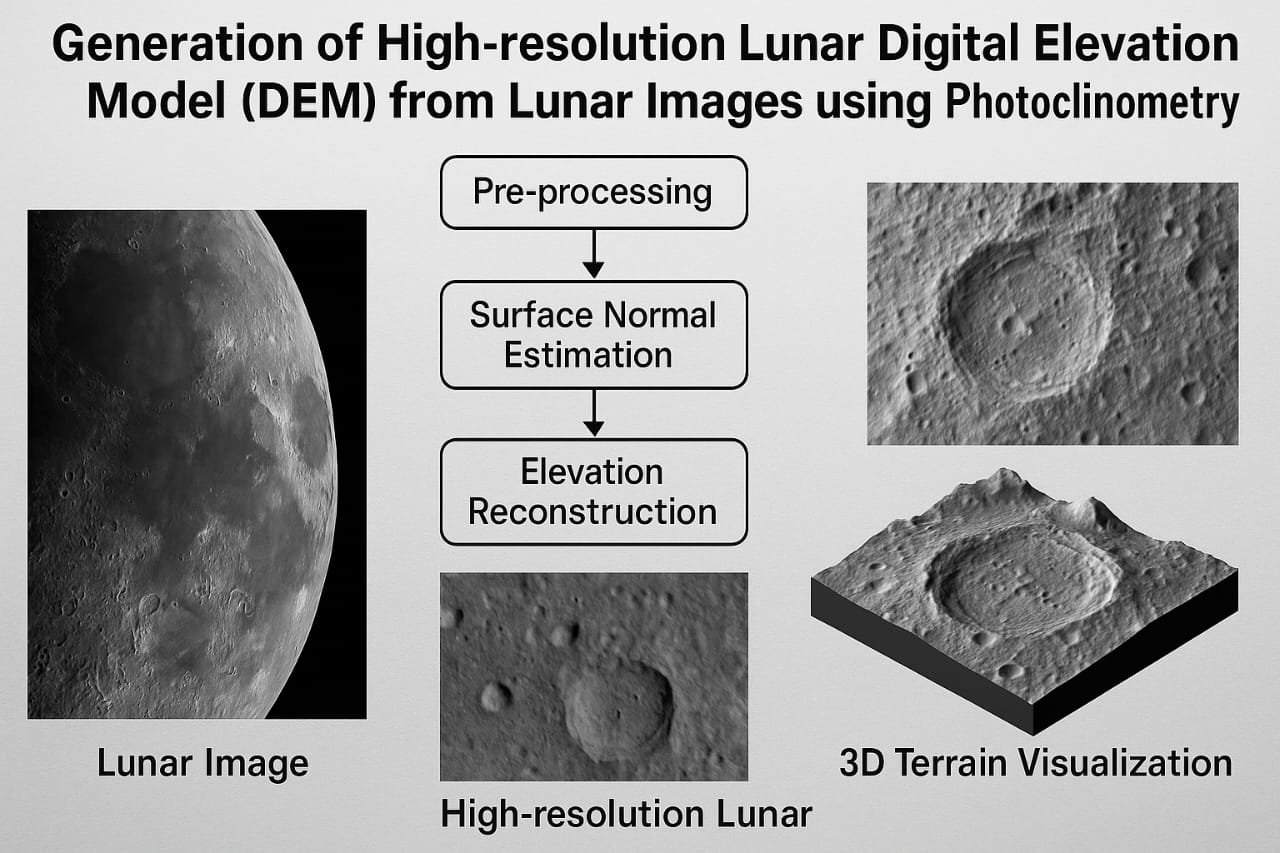
🌙 Generation of High-resolution Lunar Digital Elevation Model (DEM) from Lunar Images using Photoclinometry This project focuses on the reconstruction of high-resolution Digital Elevation Models (DEMs) of the lunar surface using a computer vision technique called photoclinometry, also known as shape-from-shading. By analyzing the light and shadow variations in 2D lunar images, the project estimates 3D surface elevations, enabling accurate topographic modeling of the moon. The process involves pre-processing lunar images, estimating surface normals based on shading, applying iterative solvers for elevation reconstruction, and validating with known DEM datasets. The resulting model supports scientific research, lunar exploration planning, and rover navigation in complex terrains, combining space science with advanced image processing and computational modeling.